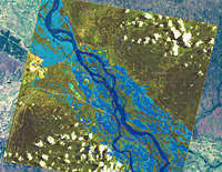
A review of crisis response using Earth observation techniques is now available online. The Respond Atlas outlines global events where remote sensing assisted in preparing for and responding to disasters and humanitarian crises.
The Respond project began in 2004 as a European Global Monitoring for Environment and Security (GMES) initiative. During its five years of service, hundreds of maps were produced to assist in relief efforts linked to crises such as the aftermath of Cyclone Nargis, the 2004 Asian tsunami and even Sudan’s refugee situation in Darfur.
http://www.esa.int/esaEO/SEMPBNWWVUG_index_0.html

Nenhum comentário:
Postar um comentário